
In an initiative to protect native desert wildlife and restore critical ecological corridors in Southern California, the conservation organization Wildlands Network has announced a comprehensive research study along State Route 62. The biological investigation will concentrate on monitoring and analyzing wildlife movement across the desert stretch connecting Yucca Valley and Palm Springs.
The planned field research is designed to establish foundational data ahead of the construction of two dedicated wildlife crossings over the highway, situated east of the Victor Valley. Conservation scientists and transportation planners aim to utilize the study's findings to understand how the existing highway fragments the surrounding Mojave Desert habitat and how engineered overpasses can best restore movement.
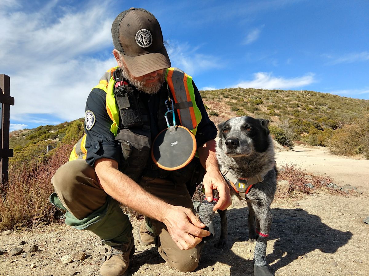
To gather necessary biological information without disrupting local wildlife populations, the Wildlands Network is deploying non-invasive survey techniques. Specialized survey teams—incorporating both trained rescue scent dogs and experienced field biologists—will canvass the target landscape to locate evidence of animal activity, placing particular emphasis on mountain lions and bobcats.
These canine-assisted teams will work alongside biologists who maintain a deep understanding of animal tracking, signs, and behavioral patterns in desert environments. The detection dogs are trained to pinpoint animal scats, or fecal droppings, which serve as essential indicators of carnivore presence and territory usage along the highway corridor.
Concurrently, a specialized research team possessing extensive experience in studying desert bighorn sheep will lead the search for bighorn scat. This team brings years of dedicated field experience assessing bighorn movement, habitat utilization, and genetic trends across the Mojave Desert.
Once gathered from the field, all scat samples will be submitted to specialized diagnostic laboratories for DNA extraction and analysis. By isolating genetic markers from the droppings, scientists will be able to identify individual animals, document their proximity to the roadway, and measure the current level of genetic exchange taking place across the highway divide.
The fieldwork has been organized into two designated survey sessions. The initial survey focused on desert bighorn sheep is scheduled to take place on September 25, running from 9 a.m. to noon. Subsequently, dog-assisted surveys conducted by Rogue Detection Teams are scheduled for October 6, also taking place between 9 a.m. and noon.
The urgency surrounding the survey and the future overpass infrastructure is underscored by rising wildlife mortalities and ongoing habitat fragmentation. Findings from independent studies, public agencies, and conservationists have consistently highlighted the need for dedicated crossing infrastructure along this heavily traveled corridor to prevent animal strikes and protect motorists.
Maintaining landscape connectivity remains crucial for preserving the long-term health and viability of regional wildlife, including mountain lions, bighorn sheep, bobcats, and mule deer. When busy transit corridors sever natural habitats, isolated wildlife populations become increasingly susceptible to genetic inbreeding, diminished vitality, and heightened vulnerability to disease.
Environmental pressures across State Route 62 have escalated markedly over the past decade. A combination of ongoing residential growth throughout the Morongo Basin and a threefold surge in visitation to Joshua Tree National Park has substantially increased vehicle volumes along the desert highway.
This rise in traffic has led to severe consequences at specific roadway bottlenecks. The two proposed wildlife overpasses are planned for critical locations at the Morongo and Yucca grades along State Route 62, where multiple wildlife casualties—including mountain lions, black bears, deer, and bighorn sheep—have been recorded within a single year.
To maximize the likelihood of wildlife adoption, the engineering plans for the two overpasses prioritize natural integration with the surrounding terrain. Each crossing will feature an earthen base cultivated with native vegetation that mirrors the plant communities found in adjacent natural areas.
Complementing the vegetated spans, the project design incorporates extensive directional wildlife fencing installed along both sides of State Route 62 to steer animals safely toward the structures. The project plans also include dedicated infrastructure measures to mitigate vehicle headlight glare and dampen highway traffic noise.
In addition to shaping the structural design of the overpasses, the upcoming surveys will establish an essential baseline of wildlife activity. This scientific benchmark will enable researchers to document how native species interact with the roadway prior to construction and evaluate the ultimate effectiveness of the crossings once completed.
The ongoing planning and long-term wildlife monitoring effort are supported through dedicated grant funding. Key financial backing for the partnership has been awarded by the California Wildlife Conservation Board and the Coachella Valley Mountains Conservancy to advance the wildlife crossing initiative.








(0)