
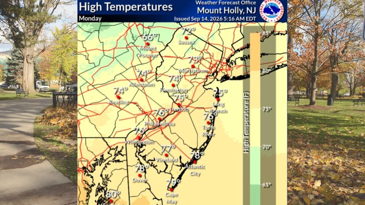
New Jersey residents are enjoying an exceptionally pleasant start to the middle of September, characterized by expansive blue skies, crisp air, and comfortable daytime temperatures throughout the Garden State. Regional weather forecasters report that stable and dry conditions will remain firmly in place over the coming days, creating ideal weather for outdoor routines, commutes, and recreation across the state.
High temperatures on Tuesday are forecast to settle comfortably in the 70s statewide. A slight regional variation will be noticeable depending on location, with northwestern counties expected to top out in the lower 70s, while the vast majority of central, southern, and eastern sections of the state climb smoothly into the mid- to upper 70s under bright sunshine.
Complementing Tuesday's mild afternoon readings is a distinct lack of atmospheric moisture, keeping humidity levels comfortably low. This combination of gentle warmth and dry air delivers a crisp, refreshing feel that is expected to persist from the morning hours straight through the evening across New Jersey communities.
The dry pattern established early in the week is not merely a brief pause in unsettled weather. Forecasters emphasize that rain-free conditions will continue across the region through at least Thursday, providing several consecutive days of reliable sunshine and tranquil outdoor conditions for residents statewide.
As the workweek progresses into Wednesday, the regional atmospheric pattern will undergo a noticeable warming trend. Afternoon high temperatures are projected to climb into the low to mid-80s across most of New Jersey, bringing warmer conditions alongside continued mostly sunny skies from north to south.
Along with the climbing mercury, Wednesday and Thursday will also introduce a gradual uptick in atmospheric moisture. The low humidity levels that defined the early part of the week will slowly give way to increasing humidity, though the overall pattern will remain largely bright and mostly sunny throughout both days.
Thursday afternoon is slated to sustain this late-summer warmth, with maximum temperatures once again reaching into the low to mid-80s. Residents can anticipate another predominantly clear day before minor atmospheric shifts begin to take shape later in the evening and during the overnight hours.
The initial potential interruption to New Jersey's extended dry spell will arrive late Thursday night and linger into Friday. An approaching cold front is forecast to push across the region during this time frame, introducing a chance of isolated or scattered showers to parts of the state.
Despite the passage of this frontal system, precipitation amounts and coverage are expected to remain quite limited. The National Weather Service notes that while certain areas could see brief rain showers, a substantial portion of the state may manage to remain entirely dry as the front sweeps through.
By Friday daytime, any lingering precipitation chances will subside, allowing mostly sunny skies to reemerge across New Jersey. High temperatures will continue to hover above average for mid-September, with afternoon maximums expected to reach back into the low to mid-80s.
Heading into the upcoming weekend, Saturday is currently projected to offer the most favorable and stable weather for outdoor plans. High temperatures are anticipated to ease slightly back down into the comfortable 70s, complemented by mostly sunny skies across the region.
The calm conditions that highlight Saturday will begin to transition as Sunday approaches. Increasing cloud cover will gradually overspread the state during the day on Sunday, signaling the arrival of another weather disturbance that will impact local conditions.
Forecasters anticipate that the thicker cloud cover on Sunday will bring a renewed chance for rain showers and thunderstorms across New Jersey. This unsettled pattern will not be confined entirely to Sunday afternoon, as precipitation opportunities are expected to extend through the night and persist into Monday.
Meteorologists have pointed out that a degree of uncertainty remains regarding the specific timing, duration, and geographic distribution of the weekend storm system. However, they have clarified that severe weather is not anticipated to develop with any of the showers or thunderstorms that materialize.
Alongside the shifting short-term weather outlook, regional forecasters have also provided updates on New Jersey's upcoming fall foliage season. Seasonal projections indicate that leaf colors are expected to be somewhat dull in certain portions of the state, while other areas are anticipated to produce good, vibrant displays of autumn color as the season progresses.






(0)