
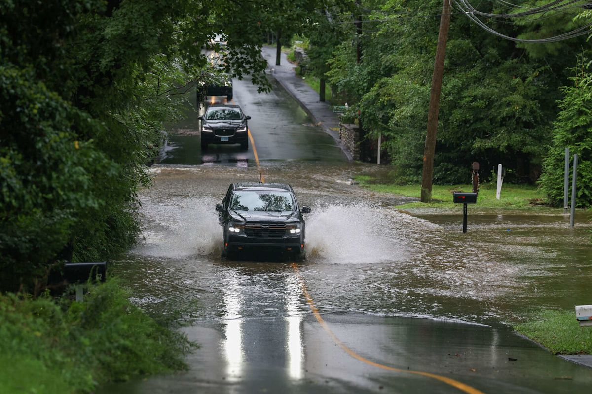
A powerful late-summer storm system swept across Connecticut on Sunday morning, September 13, 2026, unleashing torrential downpours that saturated ground across the state and pushed rainfall measurements close to seven inches in the hardest-hit communities. The rapid accumulation of water overwhelmed local drainage networks, creating hazardous conditions and significant municipal disruptions.
The intense precipitation triggered widespread flash flooding across numerous cities and towns, forcing emergency officials and local authorities to close multiple flooded roadways to traffic. Among the affected municipalities was Westport, where rising floodwaters inundated thoroughfares during the morning rush of severe weather, complicating travel and prompting safety warnings for motorists.
According to meteorological reports, the most intense and disruptive phase of the weather event was concentrated during the early hours of Sunday morning. As the storm system tracked across the state, it dumped excessive amounts of rain over a compressed timeframe before gradually tapering off. By the afternoon, the active storm bands had moved out, leaving behind overcast skies and mostly dry conditions for the remainder of the day.
Ahead of the storm's arrival, the National Weather Service had issued a series of flood watches and warnings across the region. Forecasters warned that the incoming system had the potential to drop excessive moisture capable of generating rapid runoff, alerting residents and emergency management personnel in advance of the anticipated deluge.
Meteorologists specifically identified several types of terrain and infrastructure that faced elevated risks during the storm. The weather service noted that urban environments, low-lying regions, and neighborhoods with poor drainage capacity were especially vulnerable to flash flooding, along with areas situated immediately adjacent to fast-rising creeks, streams, and rivers.
Data collected and verified by the National Weather Service revealed a dramatic variation in rainfall totals across the state, with coastal and southern communities bearing the brunt of the storm's heaviest downpours. The highest accumulation recorded statewide occurred in the shoreline town of Branford, where rain gauges registered an extraordinary total of 6.98 inches.
Fairfield County also experienced extensive precipitation that contributed heavily to localized street flooding and travel delays. In the town of Fairfield, rainfall reached 5.95 inches, while the city of Stamford recorded 5.14 inches. Bridgeport, the state's most populous city, measured 4.25 inches of rain during the morning downpour.
Other communities situated along the southwestern coastline and immediate inland corridors reported significant rainfall figures that exceeded three inches. In Greenwich, precipitation levels reached 3.78 inches, while Milford recorded 3.81 inches and Orange measured 3.52 inches over the course of the storm event.
Central Connecticut communities similarly contended with heavy accumulations that pushed local drainage systems to their limits. In Wallingford, weather stations recorded 4.88 inches of rain, while nearby Durham reported 3.68 inches. Farther south in New Haven County, Hamden saw 3.4 inches, and Shelton in Fairfield County logged 3.25 inches.
Eastern and southeastern sections of the state were also subjected to heavy downpours throughout Sunday morning. The town of Salem emerged as one of the wettest locations in the region, receiving 5.4 inches of rain. North Stonington registered 4.08 inches, New London recorded 3.93 inches, and the community of Lyme documented 3.63 inches of precipitation.
Moving farther inland and into western Connecticut, the recorded totals decreased moderately compared to the coastal deluge. Danbury logged 2.24 inches of rainfall, while eastern inland towns like Sprague and Mansfield recorded 2.11 inches and 1.8 inches, respectively, as the core bands of heavy rain remained focused further south.
The greater Hartford metropolitan area and portions of the upper Naugatuck Valley experienced comparatively lighter, though steady, amounts of precipitation. Hartford recorded 1.22 inches of rain, while nearby Farmington logged 1.15 inches. In Waterbury, gauges collected 1.28 inches, Thomaston registered 1.1 inches, and Windsor Locks reported 1.07 inches.
The lowest precipitation measurements statewide were observed across the northern and northeastern fringes of Connecticut, where the storm system proved far less severe. Torrington in the northwest hills recorded 0.97 of an inch, while Willington saw 0.8 of an inch and Willimantic documented the lowest reported total at 0.6 of an inch.
Although the morning storm caused significant disruption and widespread flash flooding, the rapid improvement in weather conditions by Sunday afternoon allowed municipal crews to begin assessing road conditions and addressing standing water. The transition to cloudy, dry weather helped alleviate immediate flood threats as swollen streams and drainage basins gradually began to recede.
The September 13 weather event highlighted a stark geographical divide across Connecticut, leaving southern coastal towns to manage the aftermath of nearly seven inches of rapid precipitation, while northern communities escaped with minor rainfall and minimal impact.









(0)