
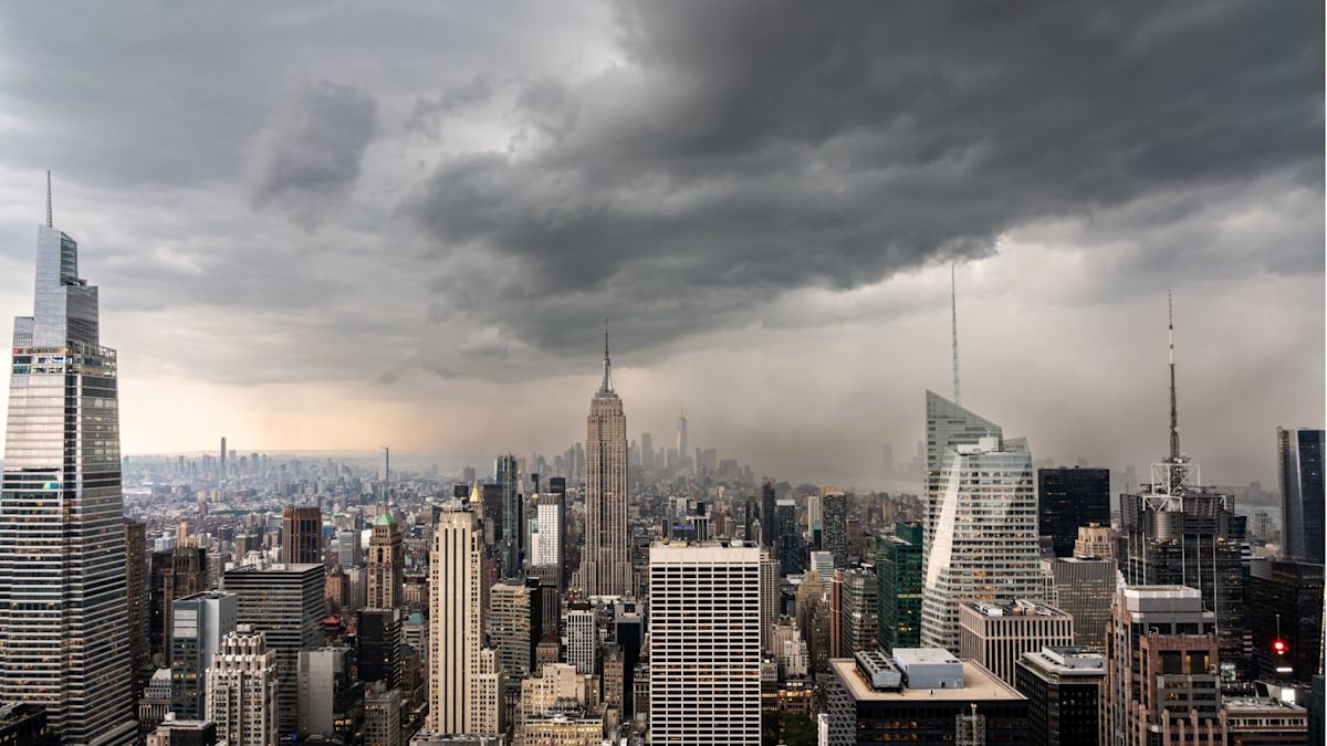
New York City authorities have placed the entire metropolitan area on high alert as severe thunderstorms threaten to trigger rapid flash flooding throughout Sunday morning. With a regional Flood Watch remaining active through Sunday midday, municipal agencies have mobilized comprehensive safety protocols while regional transit networks and major aviation hubs grapple with extensive operational disruptions.
The sudden influx of turbulent weather and heavy precipitation prompted immediate ground stops across the region’s primary airports, including John F. Kennedy International, LaGuardia, and Newark Liberty International. Flight operations were severely restricted as intense thunderstorm activity moved across the flight corridors, stranding travelers and complicating air traffic control management during one of the weekend's busiest travel periods.
In response to the escalating environmental hazard, municipal officials took the proactive step of opening 51 overnight emergency shelters on Saturday night. These temporary refuges were specifically established to provide a safe haven for residents displaced by water intrusion or those residing in structurally vulnerable quarters. To ensure that fewer barriers prevent residents from seeking protection, the facilities were fully prepared to accommodate domestic pets alongside certified service animals.
City leadership placed particular emphasis on safeguarding individuals who reside in basement apartments and other below-grade residential spaces. Historical storm events have demonstrated that subterranean living quarters face disproportionate danger during rapid cloudbursts, prompting emergency planners to prioritize outreach to tenants in these high-risk accommodations well before water levels begin to surge.
According to meteorological assessments, the window of maximum danger is projected to unfold between 5 a.m. and 10 a.m. on Sunday. During these early morning hours, atmospheric conditions are expected to align to produce the most concentrated downpours, heightening the probability of flash flooding occurring across neighborhoods before daylight fully emerges.
Projections from the National Weather Service indicate that general accumulation across the five boroughs will reach between 1.5 and 3 inches of rain. Forecasters have cautioned that the heaviest cumulative totals are likely to concentrate across eastern Brooklyn and Queens, though localized microclimates could easily generate significantly higher amounts if storm cells stall over particular communities.
Compounding the hazard is the exceptional rate at which the moisture is expected to fall. Meteorologists noted that rainfall intensity could reach between 1 and 2 inches per hour, with the most severe thunderstorm bands capable of unleashing up to 2.5 inches within a single sixty-minute span. Such extraordinary volumes present acute challenges for urban topography, where impermeable concrete surfaces accelerate surface runoff.
These torrential precipitation rates are anticipated to quickly overwhelm low-lying sectors, highway underpasses, and neighborhoods historically plagued by chronic drainage deficiencies. Infrastructure experts and emergency managers note that when rain falls at rates exceeding 2 inches per hour, water accumulation on paved roadways occurs almost instantaneously, creating hazardous standing ponds and flash conditions.
Preparations for the severe weather system began well in advance of the weekend. NYC Emergency Management formally activated the municipal Flash Flood Emergency Plan on Thursday, initiating coordinated cross-agency efforts to brace the city for severe impacts. As part of this comprehensive protocol, municipal utility and maintenance crews were deployed across the boroughs to clear debris from catch basins and preposition specialized response resources in vulnerable sectors.
Addressing the public as the storm approached, Mayor Zohran Mamdani underscored the around-the-clock commitment of city personnel while stressing the critical importance of individual household readiness. Mamdani stated that emergency crews and municipal agencies would maintain active operations through the night while the majority of the city remained asleep, actively monitoring drainage infrastructure and preparing rapid response capabilities.
Mayor Mamdani specifically called upon basement tenants to establish clear emergency egress plans prior to retiring for the night, advising them to remain prepared to immediately transition to higher elevations should water begin to enter their buildings. The mayor additionally cautioned motorists against navigating flooded thoroughfares, urging drivers to afford themselves substantial extra transit time and to never attempt driving across inundated roadways.
To maintain continuous public awareness, city officials urged residents to stay connected through official municipal communication channels, emphasizing that New Yorkers can receive real-time localized emergency notifications by texting the designated keyword NOTIFYNYC to 692-692. Leadership stressed that early communication, coupled with neighbors checking on vulnerable community members, serves as a vital safeguard during rapid-onset weather emergencies.
The acute danger posed by rapid water accumulation was further detailed by NYC Emergency Management Commissioner Christina Farrell, who warned that intense cloudbursts can compromise urban drainage networks in a matter of minutes. Farrell emphasized that the most dangerous aspect of the current weather pattern is its timing, as peak precipitation rates will coincide with the early morning hours when residents are typically asleep and less attuned to shifting environmental cues.
Commissioner Farrell reiterated that the strongest convective cells could deliver between 2 and 2.5 inches of rain in an hour, reiterating that residents in low-lying dwellings must not delay taking defensive measures until floodwaters become visibly apparent. Emergency management officials maintain that advance planning is crucial, as rapidly rising water can swiftly block exits and incapacitate ground-floor infrastructure.
Forecasters project that regional weather conditions will begin a noticeable stabilization by Sunday afternoon as the primary convective system migrates eastward, away from the city center. However, officials noted that residual standing water and lingering transportation snarls could persist well after the heaviest rainfall subsides, requiring continued caution from the traveling public.
Throughout the duration of the event, authorities continue to urge all New Yorkers to maintain fully charged electronic devices, monitor official weather broadcasts, steer clear of waterlogged streets, and assist elderly or mobility-impaired neighbors. In the event of immediate life-threatening danger or trapped individuals, residents are directed to contact emergency dispatchers immediately via 911.


(0)